Hawassa university, in collaboration with Aahrus University of Denmark, conducted a comprehensive geophysical investigation and bathymetric survey of Lake Hawassa in a 10-day campaign as a component of the Rapid Groundwater Resource Mapping (RGWM) Project for Integrated Water Resource Management in Ethiopia from April 14 to April 23, 2026.
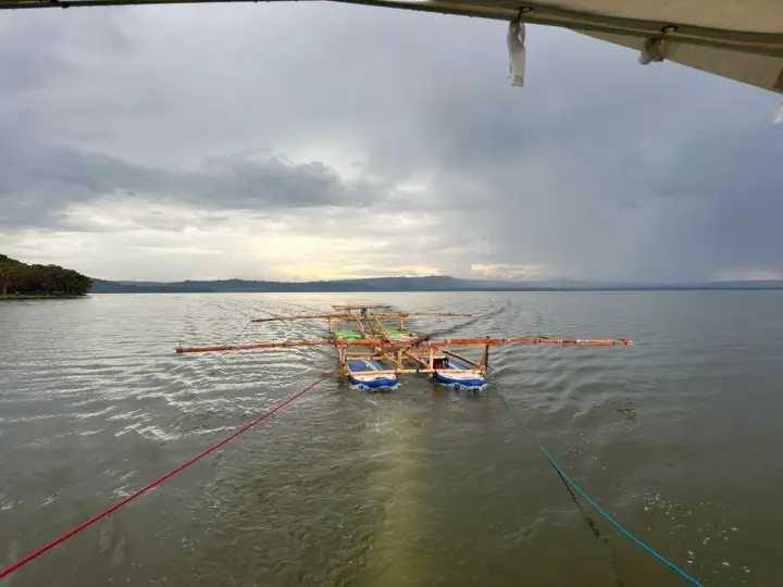
According to Dr. Eng. Mulugeta Dadi, Project Coordinator for Hawassa University, the primary objectives of the campaign were to characterize the subsurface geological structure beneath the lake to depths exceeding 100 meters using a custom-designed high-moment waterborne Transient Electromagnetic (Float TEM) system, and to map the lake’s bathymetry using SONAR technology. He noted that this survey represents a landmark achievement as it is the first known application of any waterborne transient electromagnetic (Float TEM) method for subsurface imaging beneath a lake in Africa, with the sole exception of South Africa.

Dr. Mulugeta added that no such investigation has ever been conducted in Ethiopia or else where on the African continent, this project has introduced a new scientific capability for African hydrogeophysics, moving beyond traditional land-based resistivity.
The survey successfully acquired about 300 kilometers of lines of high-quality Float TEM data along east-west oriented traverses covering the entire lake, and over 1,000 individual SONAR depth of the lake were collected to generate a detailed bathymetric map.
The project has successfully transferred advanced hydrogeophysical skills to Ethiopian experts, enhancing national capacity for sustainable water resource evaluation and management.